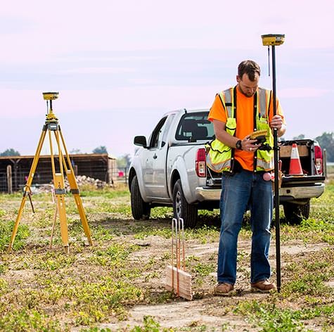
Construction Survey/Layout
Build the Design
Leveraging the partnership between Topcon and Autodesk, design files now move seamlessly from the engineers to mobile field crews.
Leveraging the partnership between Topcon and Autodesk, design files now move seamlessly from the engineers to mobile field crews.
CONTROL INFORMATION — AND FINISHED PRODUCT
The right management tools improve your results. Topcon software combined with field-ready GNSS receivers for rough stakeout and high-end optical equipment for precise work give you a broad array of positioning solutions for all your construction needs.
TAKE CONTROL OF SMALL SITE LAYOUT
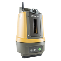
The Topcon LN-100 layout navigator strips away complexity to deliver an easy-to-use tool dedicated to small site construction layout.
Driving your layout navigator is clear and simple using a hand-held field controller hosting MAGNET Field Layout software customized for you. The companion software of MAGNET Office Layout is an ideal option for converting each PDF of design data into production, isolating and annotating for field efforts, and sharing with mobile field crews instantly.
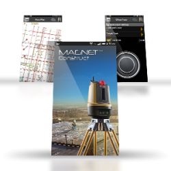
For a bring your own device (BYOD) option, take control of your layout navigator with the no-cost MAGNET Construct app for Android devices. Simple yet powerful, MAGNET Construct arrives just in time to perform just the right tasks and even connect to your private Company Account within the MAGNET system.
Lastly, let the system do it's magic by connecting your field and office platforms using MAGNET Enterprise's secure web services.
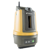
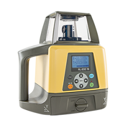
LN-100 Layout Navigator
3D layout system
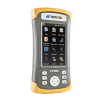
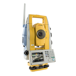
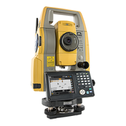
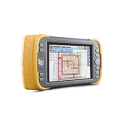
FC-500
Portrait touch-screen controller
MAGNET Construct
Mobile app control for robotic total stations and Layout Navigator
MAGNET Field
Data collection software.
MAGNET Office Layout
Layout preparation software

MAGNET Enterprise
Collaborative and secure web services for geospatial.
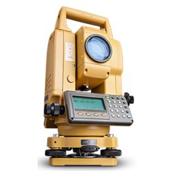
FAST, SIMPLE, SINGLE-PERSON OPERATION

Forged from decades of optical product innovation, the LN-100 layout navigator inherits precision and quality, yet delivers simplicity and performance.
Daily setup is as simple as choosing a convenient location, securing to a tripod or column clamp, and single-button power up. Watch as the layout navigator takes it from there to perform its own self-leveling routine and automatically connect wirelessly to you.
Data entry options are waiting. Move forward with a direct download from your centralized MAGNET Company Account and import, or quickly enter manual information with confidence.
With connections made and design data verified, the time is now to simple tap the screen and task the layout navigator to guide you to each location with speed and confidence. Measure what is there, layout what is going to be there using constant and real time positioning hosted by your LN-100 device.
Now a single operator is empowered to move anywhere on your project site to check previous work, layout with ease, and stay connected to the larger picture.
GNSS SOLUTIONS BUILT FOR SPEED
Ideal for rough staking and large-scale layout, as well as grade checking throughout the life cycle of a construction project, Topcon GNSS solutions provide results and a competitive edge.
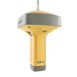
Just what you need, the Topcon HiPer SR receiver is simplistic and field ready. Daily setup could not be easier using Topcon's LongLink communication method. Once your mobile base is started, up to three remaining rover receivers are automatically hosted and eager to perform.
For project sites that have cellular coverage, the same two HiPer SR receiver are able to be used within a MAGNET Relay session, turning your mobile base receiver into a hosting reference station that drastically increases your productivity zone.
The switch from a mobile base and rover RTK session to a MAGNET Relay option are simple screen taps on your FC-500 field controller with modern MAGNET Field data collection software.
Managers stay informed using a graphical "project health dashboard" available within MAGNET Enterprise on any web browser or while on the move with MAGNET Enterprise Mobile app for iPad devices.
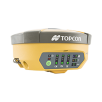
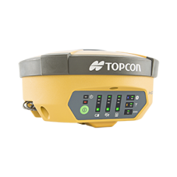
HiPer V
Versatile integrated receiver
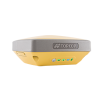
HiPer SR
Compact lightweight site receiver
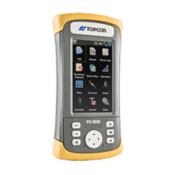
FC-500
Portrait touch-screen controller
MAGNET Field
Data collection software.
SKY'S THE LIMIT
Topcon GNSS solutions come in a variety of features and options based on your project and budget needs. Let your project sites dictate the tool that you choose for the job.
Go further and expand your project horizon knowing that you have the flexibility to change your mind with daily setup options using MAGNET Field software. Go deeper and share insightful information with each unique stakeholder along the way.
Stake Reports within the MAGNET system give you the power to set your own standards, see only what you need, and share with team members along the way.
Within the MAGNET system, leverage Stake Reports to their full capability:
- Declare stakeout tolerances to provide a visual and audible alarm if field work exceeds your custom choice
- Quickly customize how resulting construction layout information is visually displayed
- Rely on what you have done so far by verifying each report with field annotations
- Share results with all remaining MAGNET products seamlessly
Topcon's proven GNSS hardware combined with modern and graphical MAGNET system of solutions enables you and your team to get tasks done faster, jobs done better, and projects more profitable.
ADAPTABLE ADVANTAGES FOR PROVEN RESULTS
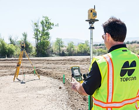
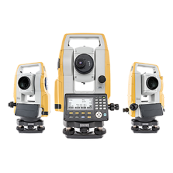
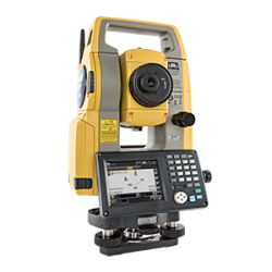
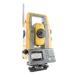
The Topcon DS series of optical total stations are fully featured robotic systems that combine imaging and remote connectivity. Drive the system with a hand-held FC-500 field controller and see what needs to be done next even in bright sunlight.
Connected and proven, MAGNET Field data collection software gives you a wide range graphical options to bring your design ideas into reality. Start with the large library of industry file formats to import, check, and perform - then tackle any task.
Likewise, a project's field work is a part of the larger picture. MAGNET Enterprise sits at the center of the entire MAGNET system providing managers secure access to not only their project data, but each member of the team even while on the go using MAGNET Enterprise Mobile app for iPad devices.
The final piece of a full solution is MAGNET Office Tools software that serves at every phase of your project. Start things off with confidence by choosing from a massive listing of supporting file formats to visually verify prior to ever going outside. Process field work and customize your reports on-the-fly yet pause along the way to see your data with a satellite image background. Using MAGNET Office Tools within the MAGNET system, your office staff is always on standby to keep your construction stakeout on time and on task.
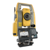
DS series
Auto-pointing total station
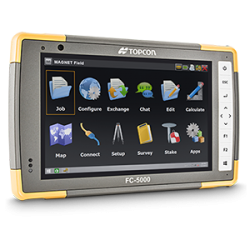
FC-500
Portrait touch-screen controller
MAGNET Field
Data collection software.
MAGNET Enterprise
Collaborative and secure web services for geospatial.
MAGNET Office Tools
Process and design solutions.
OPTIMIZED OPTICAL LAYOUT
Arriving onsite knowing that you have the right tools for the ever changing project site. MAGNET Field data collection software stays with you to drive your optical total station from vast distances using Topcon's LongLink communication method.
Still connected, take advantage of effective customization options, manage stakeout tolerances for each specific task, and even receive both visual and audible alerts if any field measurement meets or exceeds your setup.
Above and all around, MAGNET Enterprise serves as more than just immediate file transfer, it is your project command platform. Each project connects to a particular client listing, weather forecasts help with planning, specific tasks can created, assigned, and fulfilled. True project management that brings each team member together.
An array of options waits within MAGNET Office software suite. Design data that starts in the popular PDF format are easily imported, scaled, vectorized, annotated, and used. Stop and gain confidence at any time with a quick window selection and a right button click to visualize in 3D and fly through.
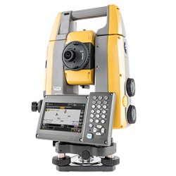
SINGLE-USER STAKEOUT WITH HYBRID POSITIONING
Robotic total stations are the industry standard for high accuracy construction stakeout.
Decades of innovation have resulted in Topcon optical products offering the most accurate and dependable prism tracking available. Topcon Hybrid solutions simply add a lightweight GNSS receiver to the mix to expands your capabilities even further.
HiPer SR
Compact lightweight site receiver
DS series
Auto-pointing total station
FC-500
Portrait touch-screen controller
MAGNET Field
Data collection software.
MAGNET Enterprise
Collaborative and secure web services for geospatial.
MAGNET Office Tools
Process and design solutions.
SYNERGY THAT DELIVERS
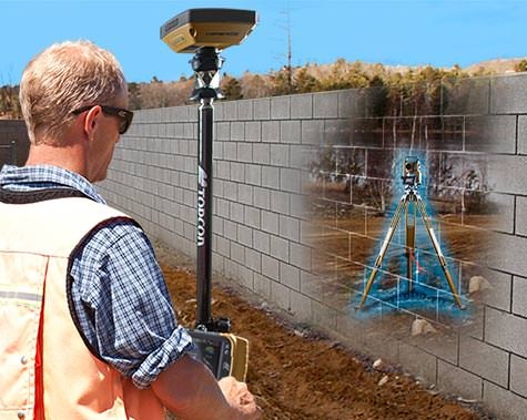
Constant dual communication to both devices of a rugged GNSS receiver as well as a small 360º prism, MAGNET Field software seamlessly switches between GNSS and robotic mode.
This interaction delivers powerful options for whatever the jobsite throws at you. As you move about, your robotic total station splits millimeters and stays locked on. When conditions dictate, a quick tap of the screen, and you are now free to move about the site to continue with GNSS positioning - production never stops.
A choice for every layout situation and approach
Field-tested instruments and advanced technology to support your success
For geopositioning, construction and mapping professionals the MAGNET suite links field to office in a secure online environment, improving management for entire teams.

Topcon GNSS products deliver superior performance through a broad array of patented technologies. Combining signals from multiple satellite systems, our GNSS products calculate highly accurate positions in three dimensions.


Topcon Total Station Solutions feature renowned optics and legendary durability combined with cutting-edge technology to maximize measurement productivity on a daily basis. With the most powerful reflectorless system available, you receive superb prism tracking and a built-in security standard.
Topcon Enterprise Solutions are revolutionary anytime/anywhere connectivity and remote
management solutions that will make every geospatial and construction firm more productive.
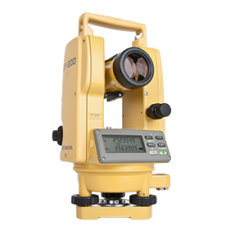
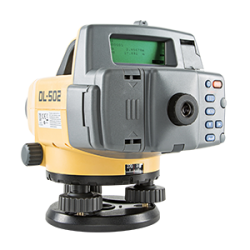
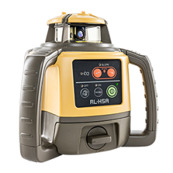
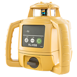
Lasers, levels and theodolites should just work. Topcon instruments remove the guesswork with auto-levelling, auto-alignment and other features that let you work faster and more accurately.

Insights & Testimonials


Contractor preps site for large auto mall
It appears that when S. Dilawri Automotive Group does something big … it is really big.

Meticulously measuring the new Provincial House in Antwerp
A remarkable silhouette is appearing on the skyline of Antwerp, the capital of the eponymous...
We've Got You Covered
Need more info?
We can email you additional product information. Your contact information will never be shared.
Reach out
Reach out to one of our partners for more information or a price quote. Use the link below to find an expert in your area ready to help your business software needs.