BIM / Vertical Construction
BIM in Vertical Construction
Increase your productivity, reduce errors, and deliver business value at every step of the process with Topcon's integrated BIM solutions.
Increase your productivity, reduce errors, and deliver business value at every step of the process with Topcon's integrated BIM solutions.
The BIM solutions to suit your needs
Discover which solution meets your needs and improve the way buildings, infrastructure and utilities are planned, designed, built and managed today.
Easily manage your modeling projects
One step farther than BIM, MAGNET VDC Solutions bring your design to 3D reality for value-based clash detection and construction phase planning. Import design models from a variety of software packages and quickly improve your design quality, enhance on-site collaboration, and get a greater ROI.
MAGNET Modeler and Explorer are now part of the MAGNET suite, providing you with simple, powerful multi-disciplinary model management.
Make managing your modeling process painless with the help of virtual design and a fully digital model-based workflow. These easy to use software solutions integrate smoothly with almost any design solutions and data formats used in construction and maintenance.
- Multi-disciplinary model management
- Collaboration tools
- Easy integration and data import
- Design analysis and simulation
- Ability to share models
- Value-based clash detection
MAGNET Explorer
Software Suite
MAGNET Explorer #01 Introduction:
MAGNET Explorer #02 Clash Detection:
MAGNET Explorer #03 4D / 5D:
MAGNET Explorer #04 Clip Planes:
MAGNET Explorer #05 Measurement:
MAGNET Explorer #06 Object Information:
Seamless Integration
Sharing between our MAGNET Software Solutions and Bentley’s ProjectWise platform is now seamless. You can import Bentley iModels right into your MAGNET Field or Office job, and even select exactly what data in the iModel you want to transfer.
Data interoperability through MAGNET Enterprise allows you to connect to your Bentley ProjectWise instance and have direct access to your projects and iModels. The iModels can then be sent to the field, used in your office projects, or stored in Enterprise Data Manager for access at any time. You can select what data you want to import such as points, linework, and more, giving you more power and functionality.
Field crews can use the iModel in MAGNET Field for their tasks and then send the updated data back to ProjectWise or to MAGNET Office Tools for processing. The direct connection between MAGNET Enterprise and Bentley ProjectWise allows users to easily integrate this new option into their daily workflows.

MAGNET Enterprise
Collaborative and secure web services for geospatial.

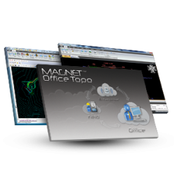
MAGNET Office Tools
Process and design solutions.
Stress-free workflows
Keep your teams productive and confident with the software they know. Office staff working within Bentley’s platform can now directly exchange specific requested data with the MAGNET system. With the interoperability between Bentley and the MAGNET System, office staff are now able to be “at the project site” virtually and ready to respond to any changes or challenges that may arise. File transfer and sharing between the two software products is more than a time saver, it’s a game changer.
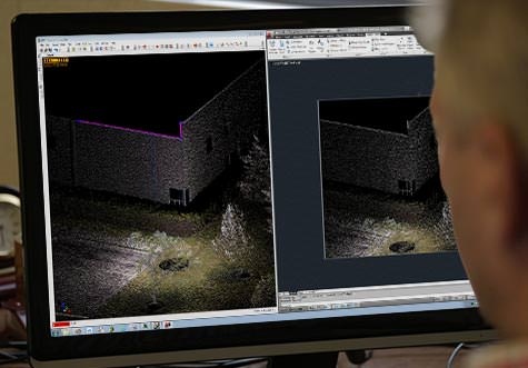
Imaging Technology and efficient software workflows for BIM Layout
Improve your performances for building layout and as-built phases of your project. This measurement system shows our commitment to automate data workflows and increase your productivity.

ImageMaster
Comprehensive reality capture
MAGNET Field
Data collection software.
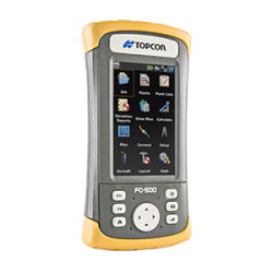
FC-500
Portrait touch-screen controller
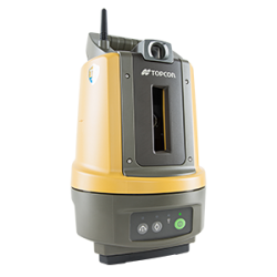
LN-100 Layout Navigator
3D layout system
Control what you measure

Perform measurement with image documentation by virtue of our Robotic Total Station functionality 'Through The Lens' (TTL). See and control what you measure, save time and costs.
The Information you need, anywhere
Add geo-reference color imagery of the project to your model. Collect existing conditions information and pictures and instantly share them with your team. Sharing information has never been more efficient.
Stay connected
Stay connected to the office to ensure design information is accurate and up to date. Pair the IS-310 with MAGNET Field software. Share and access your data within the secure MAGNET Enterprise web service. Office staff will be able to instantly share any update or changes of the design, as well as visualize results of the field measurements in real-time. Work collaboratively with our BIM solutions.
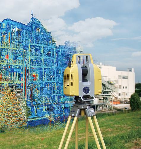
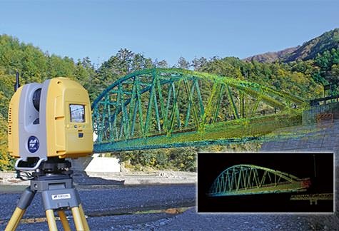
Rapid and accurate site documentation
Capture complete 3D information to describe the existing site and conditions both visually and geometrically with Topcon GLS-2000 laser scanning series. Dispose of an unmatched combination of speed, accuracy, and detail. Meet the demands of modern BIM processes even in the most challenging job sites.
MAGNET Collage
One software for multiple sensor data sets

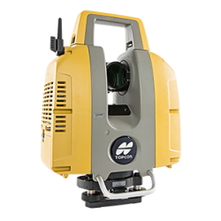
GLS-2000
Compact, high-speed series of laser scanners
Adopt Laser Scanning

Benefit from a simple and effective technology. Intuitive touch screen operation, and precise Scan Technology II (High quality scan data).
Improve Field Efficiency
Collect the highest quality of data by virtue of the unique technological innovations from Topcon. Enable effective field workflows with selectable measurement modes. Three GLS-2000 models are available based on the range requirements of the target application. You can choose the optimal scanning speed / range based on site conditions on a scan-by-scan basis. Each measurement mode setting allows you to achieve specified accuracies on just a single pass, reducing overall time per station setup.
Increase Confidence in your Results
Capture the most accurate data possible under any conditions with the GLS-2000 innovative technology. Detect timing more accurately with the Precise Scan Technology II that incorporates waveform signal processing, enhancing the GLS-2000’s time-of-flight measurements. A multiple-lens array optimizes the collimation of the laser beam based on the test range measurement. Deliver better results with these industry-leading technologies.
Deliver More Complete Information
Ensures that no detail goes uncaptured with our customizable scan resolution defaults working in combination with dual 5mp digital cameras for collecting color imagery. Capture Reality, share, and access 3d data from field to office effortlessly. After processing in ScanMaster software, export your file in a broad selection of formats, including Topcon’s widely accepted cl3, which supports today’s most requested design, analysis, and modeling applications.
Building Facility Scanning
Preliminary inspection is an indispensable component of building renovation or relocation of factory equipment. The GLS-2000 series quickly measure and collect precise 3D point clouds without interrupting your ongoing operations. Utilize high-density 3D point clouds for generating as-built drawings and for simulation of piping or equipment installation. Safely operate the GLS-2000 series of scanners even in areas where laser emission power is restricted; simply by choosing the “Low Power” (Class 1M) measurement mode.
BIM Solution Products
Topcon hardware solutions help to streamline the BIM process
For geopositioning, construction and mapping professionals the MAGNET suite links field to office in a secure online environment, improving management for entire teams.

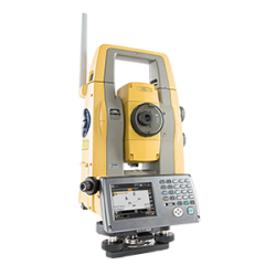
Topcon Total Station Solutions feature renowned optics and legendary durability combined with cutting-edge technology to maximize measurement productivity on a daily basis. With the most powerful reflectorless system available, you receive superb prism tracking and a built-in security standard.
A pioneer in point cloud data creation, Topcon offers various solutions to meet your requirements. These systems combine diverse technologies with user-friendly interfaces including laser scanning, GNSS, and photogrammetry.
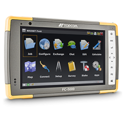
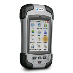
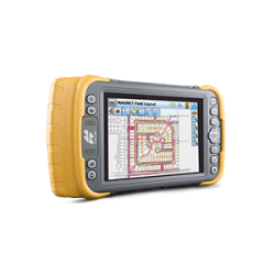
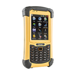
Topcon field controllers feature bright color touch screens, rugged construction, and robust computing power with Bluetooth® and WLAN connectivity.
Our software is designed for the way you work, with both specialized and modular solutions that integrate with Topcon hardware, and cloud connectivity to bring it all together.


Topcon Enterprise Solutions are revolutionary anytime/anywhere connectivity and remote
management solutions that will make every geospatial and construction firm more productive.
Insights & Testimonials


Lofty Solution
Keeping in line with its commitment to evolving technology, Missouri-based Anderson...
We've Got You Covered
Need more info?
We can email you additional product information. Your contact information will never be shared.
Reach out
Reach out to one of our partners for more information or a price quote. Use the link below to find an expert in your area ready to help your business software needs.
Topcon Today
The latest stories and insights from Topcon, our customers and partners.