Building Information Modelling
Multi-Dimensional Layout
Building Information Modelling (BIM) is changing how buildings, infrastructure and utilities are planned, designed, built and managed.
Building Information Modelling (BIM) is changing how buildings, infrastructure and utilities are planned, designed, built and managed.
Creating the Infrastructure
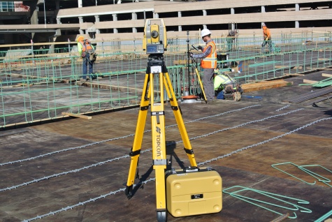
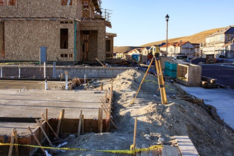
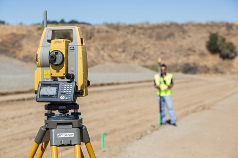
Topcon’s BIM solutions help perform fast layout of design points and quick quality control documentation. A project’s success is based on productivity, accuracy and coordination. Contribute precise as-built data back to the model as your work is done.
BIM to Field
Workflow is the most important factor for BIM users. That's why we provide a complete solution tailored to your needs.
Our workflows start by placing points in your model with Autodesk Point Layout and then sending those points to the Total Station or Layout Navigator in the field.
Through the synergy between Autodesk authoring tools and Topcon software and hardware solutions, we provide the fastest and easiest way to accomplish BIM to Field.
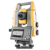
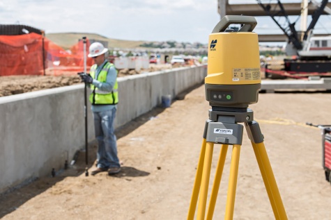
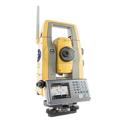
GT Series
Robotic Total Station
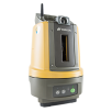
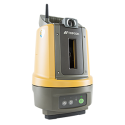
LN-100 Layout Navigator
3D layout system

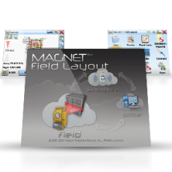
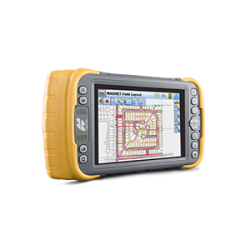
MAGNET Field Layout
Guided layout field software
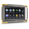
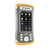
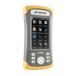
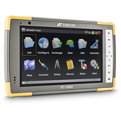
FC-5000
Capacitive multi-touchscreen controller
Accurate, Reliable and Easy to Use Solutions

Topcon / Autodesk synergistic solutions help Mechanical, Electrical, Plumbing and Wall contractors boost the performance of various teams and facility managers through improved integration and coordination.
Topcon solutions ensure accurate layout as well as reliable as-built, in the case of pre-existing parts. The final result is that prefabricated parts fit together properly. For the purpose of laying out complex curves, elaborate architectural soffits and suspended ceilings that require many points and extreme accuracy, our solutions running on a mobile device simplify the process of selecting individual points.
Better Oversight and Control of Your Construction Process

We provide the right solutions to improve accuracy and control, save time, and ultimately increase profits. Especially for Construction Management Firms and General Contractors that want to improve their workflow and the coordination of projects, teams, and data.
Our quality assurance / quality control capability (QA/QC) through Autodesk BIM 360 Layout integration, helps you to prevent and resolve conflicts in the field to save time and increase productivity.
Easy and accurate Layout

Save time and money by installing prefabrication correctly on site the first time. We ensure this by providing solutions to capture the existing conditions and layout items such as sleeves, walls, equipment, pipe, and sheet metal hangers correctly.
Our quality assurance / quality control capability (QA/QC) helps you to prevent and resolve conflicts in the field to save time and increase productivity.
DS-200i Total Station now connected to Autodesk BIM 360 Layout IOS App
Take advantage of Topcon and Autodesk synergic solutions. Benefit from the DS-200i Total Station's electronic distance measurement range of up to 1,000 meters (3,280 ft.) without the need of a prism, and 5,000 meters (26,240 ft.) with one. The reliable built-in wireless WLAN connects the iPad with the BIM 360 Layout IOS App.
Improve your QA/QC process by verifying that items in the field are installed correctly compared to models. This excellent, reflectorless solution makes it easier than ever before.
Improve accuracy with the X, Y Remote Positioning Unit

Increase your productivity and improve your BIM layout accuracy with the X,Y Remote Positioning unit. Nothing is in your way when placing points on the ground or above your head. Designed for BIM applications or concrete work, pair the X,Y Remote Positioning Unit with the LN-100 or any Topcon Robotic instrument and make layout easy.
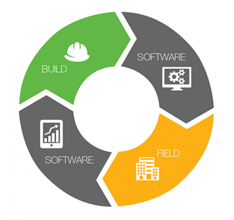
Workflow

We’ve crafted hardware and software solutions to improve our customer's Building Information Modeling workflow throughout the entire construction process.
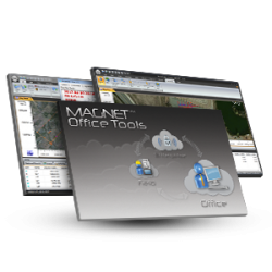
- MAGNET Office Layout
- MAGNET Enterprise
- MAGNET Field Layout
Download the Topcon Autodesk BIM2B Workflow Poster here.
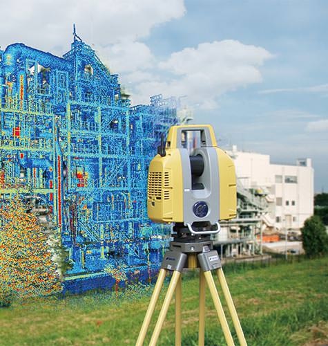
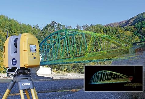
Building Facility Scanning
Preliminary inspection is an indispensable component of building renovation or relocation of factory equipment. The GLS-2000 series quickly measures and collects precise 3D point clouds without interrupting your ongoing operations. Utilize high-density 3D point clouds for generating as-built drawings and for simulation of piping or equipment installation. Safely operate the GLS-2000 series of scanners even in areas where laser emission power is restricted; simply by choosing the “Low Power” (Class 1M) measurement mode.
Rapid and Accurate Site Documentation
Meet the demands of modern construction processes even in the most challenging job sites. You can capture complete 3D information to describe the existing site and conditions both visually and geometrically with our laser scanning solutions. Our GLS-2000 series laser scanners feature an unmatched combination of speed, accuracy, and detail.
Raw reality data from the Topcon GLS-2000 laser scanner can be taken directly into Autodesk ReCap 360 and ReCap 360 Pro at any stage of the point cloud process: registration, clean-up, indexing, segmentation and more. From there the reality data captured with the GLS-2000 is ready for consumption in any Autodesk software solution such as AutoCAD, Revit, Inventor, Navisworks, Infraworks and 3ds Max.
Through the synergy between Autodesk and Topcon software and hardware solutions, we provide the fastest and easiest way to accomplish Data Capture.

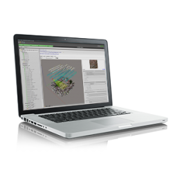
MAGNET Collage
One software for multiple sensor data sets

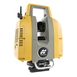
GLS-2000
Compact, high-speed series of laser scanners
Easy Laser Scanning

Benefit from simple and effective technology. You get intuitive touch screen operation and precise, high-quality data with Scan Technology II.
Improve Field Efficiency
Collect the highest quality of data with our unique technological innovations.
Selectable measurement modes let you enable effective field workflows. Three GLS-2000 models are available to meet a wide range of target application requirements.
You can choose the optimal scanning speed/range based on site conditions on a scan-by-scan basis. Each measurement mode setting allows you to achieve specified accuracies on just a single pass, reducing overall time per station setup.
Increase Confidence in your Results
Capture the most accurate data possible under any conditions with the GLS-2000 innovative technology. Detect timing more accurately with the Precise Scan Technology II which incorporates waveform signal processing, enhancing time-of-flight measurements. A multiple-lens array then optimizes the collimation of the laser beam based on the test range measurement.
Deliver More Complete Information
Ensure that no detail goes uncaptured with our customizable scan resolution defaults working in combination with dual 5mp digital cameras for collecting color imagery. You can capture reality, share, and access 3d data from field to office effortlessly.
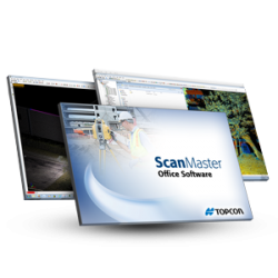
After processing in ScanMaster software, export your file in a broad selection of formats, including our widely accepted cl3, which supports today’s most requested design, analysis, and modeling applications.
Building Facility Scanning
Preliminary inspection is an indispensable component of building renovation or relocation of factory equipment. The GLS-2000 quickly measures and collects precise 3D point clouds without interrupting your ongoing operations.
Utilize high-density 3D point clouds for generating as-built drawings and for simulation of piping or equipment installation. And safely operate the GLS-2000 even in areas where laser emission power is restricted simply by choosing the Low Power (Class 1M) measurement mode.
Easy to Get Started

Scan
Scan the site using the GLS-2000 Short, Medium or Long range laser scanner.
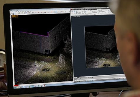
Process
View, Process and Edit the Scan Data.
Deliver
Deliver raw scan data, registered point cloud data, georeferenced point cloud data, 2D drawings, 3D models, or Building Information Models.
Building Facility Scanning
Preliminary inspection is an indispensable component of building renovation or relocation of factory equipment. The GLS-2000 quickly measures and collects precise 3D point clouds without interrupting your ongoing operations.
Utilize high-density 3D point clouds for generating as-built drawings and for simulation of piping or equipment installation.
Safely operate the GLS-2000 even in areas where laser emission power is restricted; simply by choosing the Low Power (Class 1M) measurement mode.
Traditional Construction Layout
Access and share your data with your team and move from plan to building layout faster than ever. With seamless communication between Field and Office your construction layout will be more accurate and efficient.
LN-100 Layout Navigator
3D layout system
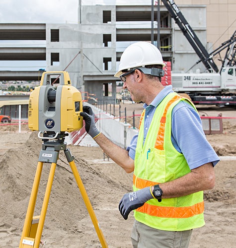
DS series
Auto-pointing total station
MAGNET Field Layout
Guided layout field software
MAGNET Construct
Mobile app control for robotic total stations and Layout Navigator
MAGNET Office Layout
Layout preparation software
FC-500
Portrait touch-screen controller
Model and Field seamlessly connected
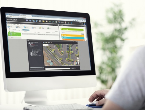
Stay connected to the office to make sure design information is always accurate and up to date. You can share and access your data securely within the MAGNET Enterprise web service. Your office staff will be able to instantly share any updates or changes to the design, as well as visualize results of the field measurements in real-time.
Fast, simple, one-person operation
Benefit from a fast, simple one-person operation with the LN-100.
Simply take a prism and either our Android based MAGNET Construct, Windows Based MAGNET Field Layout or Autodesk's BIM 360 IOS Layout controller software anywhere within the Layout zone of your project and get precise horizontal dimensions as well as vertical elevations.
The LN-100 can be mounted anywhere on site using a range of our additional accessories.
Layout at your finger tips, anywhere, at any time
Boost productivity with the MAGNET Construct no-cost app dedicated and ready to drive the LN-100 Layout Navigator device. Take advantage of intuitive options for quick field measurements.
Deliver More Complete Information
Ensure that no detail goes uncaptured with our customizable scan resolution defaults working in combination with dual 5mp digital cameras for collecting color imagery. You can capture reality, share, and access 3d data from field to office effortlessly.
After processing in ScanMaster software, export your file in a broad selection of formats, including our widely accepted cl3, which supports today’s most requested design, analysis, and modeling applications.
Building Facility Scanning
Preliminary inspection is an indispensable component of building renovation or relocation of factory equipment. The GLS-2000 quickly measures and collects precise 3D point clouds without interrupting your ongoing operations.
Utilize high-density 3D point clouds for generating as-built drawings and for simulation of piping or equipment installation. And safely operate the GLS-2000 even in areas where laser emission power is restricted simply by choosing the Low Power (Class 1M) measurement mode.
Workflow
We’ve crafted hardware and software solutions for each of the following categories to improve our customers Building Information Modeling workflow throughout the entire construction process. Construction Management General Contractors MEP/FP & Wall Contractors Download our BIM2B Workflow Poster here.
- MAGNET Office Layout
- MAGNET Enterprise
- MAGNET Field Layout
Easy to Get Started
Office Layout
Transfer plans and 3D models into accurate layout.
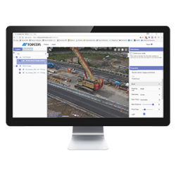
Enterprise
Store and transfer info in the field using this secure web platform.
Field Layout
Import your file from Magnet Enterprise or manually enter plans into Magnet Field Layout on the data collector. No office software is necessary.
A truly innovative breakthrough product...
Diverse technologies to support your BIM workflow
Interior or exterior, markout or measure, Topcon has a great selection of products to help you suceed.
For geopositioning, construction and mapping professionals the MAGNET suite links field to office in a secure online environment, improving management for entire teams.

Topcon Total Station Solutions feature renowned optics and legendary durability combined with cutting-edge technology to maximize measurement productivity on a daily basis. With the most powerful reflectorless system available, you receive superb prism tracking and a built-in security standard.
A pioneer in point cloud data creation, Topcon offers various solutions to meet your requirements. These systems combine diverse technologies with user-friendly interfaces including laser scanning, GNSS, and photogrammetry.
Topcon field controllers feature bright color touch screens, rugged construction, and robust computing power with Bluetooth® and WLAN connectivity.
Our software is designed for the way you work, with both specialized and modular solutions that integrate with Topcon hardware, and cloud connectivity to bring it all together.


Insights & Testimonials


Lofty Solution
Keeping in line with its commitment to evolving technology, Missouri-based Anderson...

Street Smarts
As part of a pilot program to prove the applicability of laser scanned data in a Smart Cities...
We've Got You Covered
Need more info?
We can email you additional product information. Your contact information will never be shared.
See it in action
Your local dealer can't wait to show you what we can do for your business.