Topography & As-Built
THE SHAPE OF THINGS TO COME
Topographic surveys are called upon to answer a broad, ever-changing range of needs and demands. Technology from Topcon is designed to meet these needs today and anticipate the demands of tomorrow.
Topographic surveys are called upon to answer a broad, ever-changing range of needs and demands. Technology from Topcon is designed to meet these needs today and anticipate the demands of tomorrow.
DEVELOPING TECHNOLOGY TO EXPAND YOUR OPTIONS
From optimizing traditional methods, to pioneering new ones, Topcon offers a solution to enhance your project's topographic mapping efforts.
Work faster and more easily
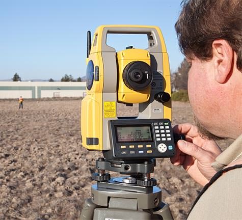
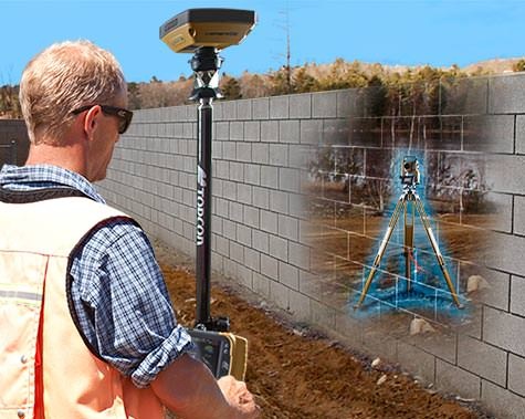
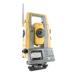
This new hybrid positioning solution brings several improvements to your workflow. First, measurements are easier and faster: the tracking speed of the GT Series robotic total station, and TILT™ leveling in the HiPer HR GNSS receiver, allow you to move faster from point to point, and capture each point faster as well.
We've made your interface easy to read and easier to navigate with the large, bright FC-5000. With improved communications range, you can do more work with fewer setups.
The new MAGNET Field 4.0 streamlines your most-used routines and assures fast, easy data connection from office to field to office. Whether your company uses Autodesk or Bentley or Topcon, our integration is seamless.
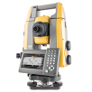
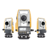
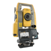
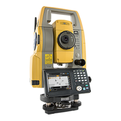
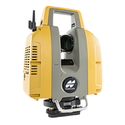
GT Series
Robotic Total Station
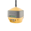
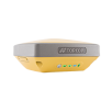
HiPer HR
Multi-Purpose GNSS Receiver
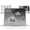
MAGNET Field
Data collection software.
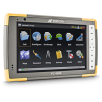
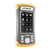
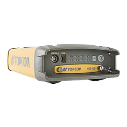
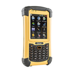
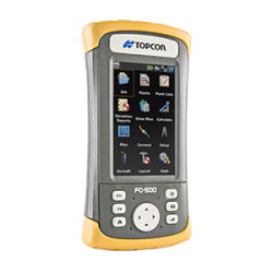
FC-5000
Capacitive multi-touchscreen controller
MAGNET Enterprise
Collaborative and secure web services for geospatial.
Greater than the sum of the parts
Each element of the Elite Suite is a powerful productivity tool. The real boost comes when they work together. Users can expect a marked increase in points per day. You'll spend less time moving data from field to office and from application to application. Common software operations are streamlined and better supported by the integration of the instruments. Critically, in marginal conditions the Elite Suite solution will deliver performance beyond the range of the competition.
Integration with both Autodesk and Bentley
MAGNET Enterprise now provides direct toolbar connection with both Autodesk 360 and Bentley ProjectWise cloud systems. Selective layer export and bi-directional file conversion for both platforms makes this connection easy and foolproof. Dozens more improvements support your most efficient workflows.
No holding back with hybrid positioning
The Elite Suite uses both GNSS and robotics in a unified system so that you can capture the shot, regardless of tree cover, loss of line of sight, or hard to reach points. And in the rare instance of losing prism lock, the GNSS information allows the robotic instrument to relock with unprecedented speed.
MUCH MORE THAN TWO
Several situations require a two person crew to arrive and quickly gather high accuracy topographic field measurements.
Whether a quick confirmation of a particular feature or tight details for a specific area, Topcon's lightweight solutions for a two person topographic team are proven.
Safety stays in focus during each session where avoidance zones can be measured and defined to then later offer visual and audible alerts when crews are encroaching any danger zones.
The math for a two person topographic team is easy: 1 + 1 = getting more done than before!
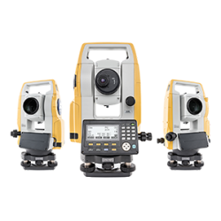
ES series
Reflectorless total station
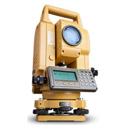
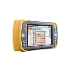
FC-500
Portrait touch-screen controller
MAGNET Field
Data collection software.

MAGNET Office Tools
Process and design solutions.
MAGNET Enterprise
Collaborative and secure web services for geospatial.
LESS IS MORE
Two person field crews maximized with modern Topcon hardware and software are able to stay connected to the office, instantly generate 3D linework with each screen tap, and even watch the digital surface come to life with each measurement to truly and accurately represent reality.
The result is more than just a single sharable file from MAGNET Field. Within the one transfer from the jobsite, MAGNET Office software will instantly inherit all 3D data, surface files, linework, photo notes, and more.
The manager then is empowered to pause and check on the project's progress using the no-cost MAGNET Enterprise Mobile app for iPad devices. Topcon's hardware and software solutions are streamlined to provide you more with less effort.
PROMOTE, CHOOSE, AND PERFORM
Robotic total station systems are a powerful asset to any field measurement project. To get the most out it, simply add a small ruggized GNSS receiver, and you now have the no compromise solution of Topcon Hybrid Positioning.
For decades, Topcon has a proven reputation for the ultimate in optical total station accuracy and dependable prism tracking. Promote your robotic total station system to “full hybrid” mode and expand those capabilities even further.
Working both with a small yet powerful GNSS receiver on top of your 360º prism, MAGNET Field data collection software helps you to seamlessly switch between GNSS and robotic mode - options. Driving a Hybrid Positioning session with MAGNET Field gives you the confidence to switch to the best option for any site condition.
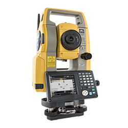
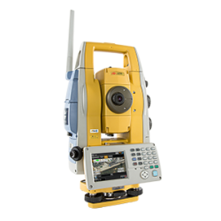
DS series
Auto-pointing total station
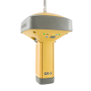
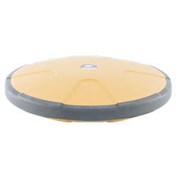
HiPer SR
Compact lightweight site receiver
MAGNET Field
Data collection software.
MAGNET Enterprise
Collaborative and secure web services for geospatial.
SWITCH AND RESPOND FOR SUCCESS
Take advantage of MAGNET Field software's exclusive feature to seamlessly switch from either optical or GNSS measurements - all from the single tap of the screen.
Both standalone RTK and network rover systems as well as robotic total stations have the opportunity to be fully promoted to Hybrid Positioning mode to get the most out of your investment. A complete Hybrid Positioning system is simply the addition of a small GNSS receiver to your robotic setup or the usage of a robotic system with your GNSS rover.
Conditions on project sites often change. During a Hybrid session, the system automatically maintains communication to both the robotic total station as well as the GNSS receiver on top.
This constant dual communication provides you the time saving feature of Hybrid Lock. The system “knows“ the location of the receiver and quickly calls the instrument to reacquire prism lock. Keeping you productive no matter what the site throws at you.
ON-THE-FLY PRECISION
Eliminate optical line-of-sight restrictions from your project site survey. Even within challenging conditions for sky view, Topcon has earned a solid reputation for tracking and using every signal from above to keep you productive on the ground.
Your crew is more productive, locating site features using graphical, intuitive, and securely connected data collection software to create a realistic representation of the existing field conditions.
But the job does not end there. Instead, once the field measurements are completed, it is a hand off to the next stake holder. Field crews now transfer all data within a single sharable file as they are walking back to the vehicle. Office staff are just a click away to keep any topographic survey project not only accurate, but fast and easy.
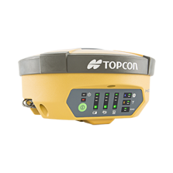
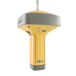
GR-5
Advanced feature-rich receiver
MAGNET Field
Data collection software.
MAGNET Enterprise
Collaborative and secure web services for geospatial.
RTK ASAP
Job site environments are notorious for throwing "changes and challenges" at us while performing our field work. Topcon's GNSS solutions for topographic efforts meet the challenge each day.
There are multiple options for loudly broadcasting corrections from your mobile base setup including integrated cellular modems, state of the art radio options, and even the convenient choice of long-range Bluetooth™ communication — simply choose the method that works best for you.
Regardless of the communication method, you can continue collecting site detail, making you more productive and more efficient than traditional optical crews.
A range of product options and
technologies to suit your needs
A broad selection of instruments and software to power your productivity for years to come.
For geopositioning, construction and mapping professionals the MAGNET suite links field to office in a secure online environment, improving management for entire teams.
Topcon GNSS products deliver superior performance through a broad array of patented technologies. Combining signals from multiple satellite systems, our GNSS products calculate highly accurate positions in three dimensions.


Topcon Total Station Solutions feature renowned optics and legendary durability combined with cutting-edge technology to maximize measurement productivity on a daily basis. With the most powerful reflectorless system available, you receive superb prism tracking and a built-in security standard.

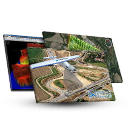
A pioneer in point cloud data creation, Topcon offers various solutions to meet your requirements. These systems combine diverse technologies with user-friendly interfaces including laser scanning, GNSS, and photogrammetry.
Our software is designed for the way you work, with both specialized and modular solutions that integrate with Topcon hardware, and cloud connectivity to bring it all together.
Topcon Enterprise Solutions are revolutionary anytime/anywhere connectivity and remote
management solutions that will make every geospatial and construction firm more productive.
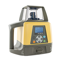
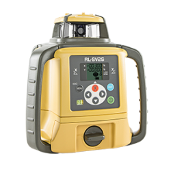
Lasers, levels and theodolites should just work. Topcon instruments remove the guesswork with auto-levelling, auto-alignment and other features that let you work faster and more accurately.
Insights & Testimonials


Lofty Solution
Keeping in line with its commitment to evolving technology, Missouri-based Anderson...
We've Got You Covered
Need more info?
We can email you additional product information. Your contact information will never be shared.
See it in action
Your local dealer can't wait to show you what we can do for your business.